The Mysterious Kanger Valley National Park
Written by B.Bindu
Located amidst the 34 kms long and scenic Kanger valley, a biosphere reserve, Kanger Valley National Park lies at a distance of 27 kms from Jagdalpur. Spread over an area of 200 sq km, the park derives its name from the Kanger river, which flows throughout its length.
Kanger Valley attained the status of a National Park in 1982. Besides wildlife and plants, this national park is home to three exceptional caves—Kutumsar, Kailash and Dandak—famous for the astounding geological formations of stalagmites and stalactites.
TIRATHGARH
Specified by the murmur sound, falling from the heights in a single drop, transforming of waterflow into a waterfall can beholded so picturesque that it doesnot depend on any particular weather. But the best view can be glanced after rainy season.
On the way to Konta from Jagdalpur, 29kms.away rightside, a path leads to Bastar attractions. The most beautiful waterfall of Bastar—Tirathgarh falls, constituted from Kanger river and its tributaries or from some small runnels like Mungabahar, attains its magnified form and flows in a perennial structure. Most of the rivers and runnels of Bastar are non-perennial but to sustain the flow of this falls, Kanger runnel (nala) always struggles. In rainy season, Titathgarh falls is water-flooded, flows in its full width alongwith its channels and gets reflected as a huge cluster of waterfalls whereas after October, it can be viewed in its pure white form.
Other falls descend from a rocky structure, fall into a fixed depth and form waterfalls, whereas Tirathgarh falls form two to three waterfalls. On the uppermost plains, it is 200m wide and 110ft height. The rock-cuts are so amazing that it give a unique view to the falls. Again, falling from the height of 125ft, it forms second waterfall. Almost after flowing 100ft, again the distributaries form numerous waterfalls flowing stepwise in 5 to 10m or 1 to 2ft. Due to these numerous waterfalls, Tirathgarh falls is referred to as a cluster of waterfalls. Here, two major waterfalls falling in two stages contribute to the total height of more than 300ft. On the uppermost side, leftwards, there is a group of four Shivalayas. This group has a Tulsi Chaura along with the idols of Nandi and other deities. The huge rocks have large beehives at places. Greenery produced by climbers all around is mesmerizing. Among these climbers, one can get a view of Ramdoot KapiSena (monkeys).
2kms. Westwards to Tirathgarh falls, there is a small village named Tirathgarh. A Shivalaya is also constructed on the topmost portion of the falls and it is being well-known as a pilgrimage centre. Every year, at the time of Mahashivratri, a Mela lasts here for 3 days and it gives a feeling similar to Kumbh festival. Thus, “Tirathgarh” name proves to be relevant.
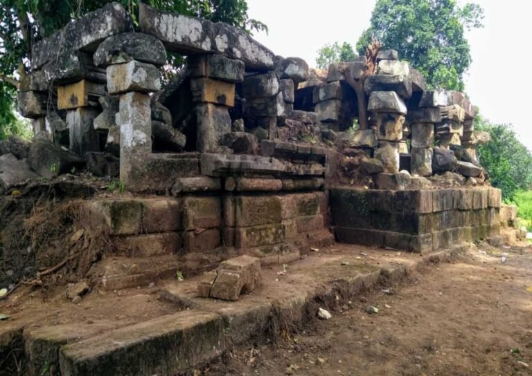
According to a folklore, there were two brothers named Tirathraj and Chingraj. Fascinated by scenic beauty, they made this part of Bastar region, their capital. Chingraj established a village named Chingithrai and constructed a grandiose temple dated back to 11th century. It is 7km.away from Tirathgarh. On the same way, Tirathraj made his garh on the lower region of Tirathgarh falls and established Tirathgarh village on the upper region, which is lively till date. Wreckage are still visible on the banks of river which are almost completely destroyed.
Keeping in view the minerals, Tokapal region is marked for Kimberlite rocks. This Kimberlite belt is spread upto Tirathgarh. Kimberlite rocks constitute diamond.
Situated in mountaineous and unhabited region, it is best to visit this place by own vehicle, while it is convenient to take food and water. Positioned at the girth of 35-40km around Jagdalpur, it is accessible in one hour. It is best to visit this place between October to February.
KANGER WATERFALL
Stepping down feet on the grounds of Bastar, tourist’s eyes get a rare glare. One such alluring place is—Kanger Waterfall.
Situated in the bio-forestry region of Kanger National Park, Kanger Waterfall is an appealing but miniature waterfall. Slowly this place is developing into a picnic spot. After creating Tirathgarh waterfalls near Tirathgarh village, crossing the National Highway, Mungabahar enters Kanger Valley National Park and flows in the form of Kanger river in the bio-forestry region, combining with Kolab river ahead.
On Jagdalpur-Konta National Highway, 26kms away from Jagdalpur, there is Kotumsar Naka. Rightwards, it leads to Tirathgarh Waterfalls and leftwards, it leads to the gateway of Kotumsar, Kailash, Dandak caves and Kanger Valley National Park. On this way, 4km away on the leftside, a board indicates that around 200m away Kanger Waterfall is noticeable with its exclusive beauty.
The uncommon elegance of Kanger Waterfall is completely capable to overwhelm tourists. Flowing through the rocky structures, Kanger river falls from a height of 30ft and creates the wonderful Kanger Waterfall.
On both the sides of Kanger Waterfall, plain rocky surfaces provide place of rest to tourists. Kanger Waterfall’s charm cannot be compared to the nearby Tirathgarh Waterfalls, and this may be the reason of its ignorance by tourists.
Tirathgarh Falls, Kotumsar caves, Kailash caves, Dandak caves and Kanger Waterfall can be developed as a group of tourist spots. Being accessible, Kanger Waterfall gives a silent invitation to visit again.
FLORA, FAUNA AND WILDLIFE
Prepare to get enchanted by rugged mountain views, deep gorges, dancing trees and seasonal wild flowers, as together they make the perfect environment for varied species of wildlife. Bastar has a fair variety of avifauna, both resident and migratory. Most of the migratory birds visit during winter, to glean the paddy fields after the kharif crop has been harvested.
As we enter the dense forests, the aroma of the wet leaves and rich soil will fill our senses with euphoria. The Kanger Valley National Park is a distinguished blend of mixed moist deciduous type of forests with a predominance of sal, teak and bamboo. It is the only region in peninsular India with pockets of virgin forests. The park is actually a transition zone where the southern limit of sal forests and the northern limit of teak forests blend. According to the survey done by the Botanical Survey of India and other research organizations, the national park has 553 floral species out of which 12 species are new to Chhattisgarh; 43 species are reported rare. Floral diversity includes insitu gene bank of medicinal plants, grasses, climbers, wild sugarcane, canes, ferns, epiphytes, sal, teak, bamboo and their rich associates.
The Kanger Valley National Park is home to thriving wildlife species like tiger, leopard, mouse deer, wild cat, caracal, bison, chausingha, wolf, chital, sambhar, barking deer, langur, flying squirrel and stripped hyena. But the biggest and the most popular specie that mesmerizes all with its human voice is the Bastar Myna. The state bird, the Bastar Myna, is a type of Hill Myna (Gracula religiosa Linnacus), and an accomplished mimic, adept at imitating the human voice. For this reason, it has been traditionally prized as a cage bird, resulting it being hunted to the point of becoming extinct. Today it is an offence to cage this bird. The Bastar Myna is a colourful bird, glossy pitch black with yellow legs, orange and yellow beak, bright yellow wattles on the head and a dash of white on the side wings. It is seen in pairs or noisy flocks in preferred locations in the forests and villages. Both the sexes of the Bastar Myna have dissimilar calls and each bird has a repertoire of 3-13 types of calls.
The forest is home to both migratory and resident birds. Most of the migratory birds visit during winter, to glean the paddy fields after the kharif crop has been harvested. The avifauna here includes the hill myna, spotted owl, red jungle fowl, peacock, parrot, steppe eagle, red spur fowl and partridge among others.
A few tributaries form marshy land in early dry season due to natural seepage. Ekta Jhodi, Kyam nallah, Karanji Jhodi, Rajamunda, Punji Jhodi, Komkel Jhodi forms good marshy areas which are good habitat of wild boar and sloth bear. Chital, barking deer, and panther are mainly found in this marshy area. Kariya Ama nallah is a perennial marshy belt and is ideal habitat for wild boar, sloth bear, chital, leopard and tiger.
NATURE TRAIL
There is a scope for a nice nature trail on the way to Tirathgarh. Lasting for about 1.5kms, this trail holds a wonderful experience for all nature lovers and wildlife enthusiasts. They can study the surroundings, take pictures and learn more about jungle-life as they stroll away deeper into leisure.
GEOLOGY
The national park has remarkable geological diversity. The national park has mainly Cuddapah group of rock formation and at some places Vindhyan group of rock formation, shales are the common rock formation of Cuddapah group, which are horizontally bedded, at many places calcareous, the other rock formation is slate.
In the northwestern part i.e. Tirathgarh, Kamanar, Kotumsar there is a outcrop of limestone, sandstone, quartzite and laterites. In northern middle part, from Nagalsar to Radhanaras, at many places, limestone is well exposed and outcrops of quartzite and laterites. Limestone caves of Kotumsar, Dandak, Devgiri and Kailash are present in this part. In the northeastern part from Pulcha to Kolab River, rock is shale and some quartzite with outcrops of granite.
In the southwestern part, rock is of vindhyan group mainly granite and sandstone. At few places granite and mica are also present. In the southern middle part, rock is of cuddapah group of quartzite and granite. At many places mica schist are present. Shale and sandstone are also outcropped. In the southeastern part, rock is primarily of cuddapah group of granite, shale, slate, sandstone and occasional quartzite outcrop. On slopes laterites are present. At some places vindhyan group of rocks are also present.
Poor and rocky soil is found on the hill tops and slopes. Recent deposits are alluvial soils, high and low level laterites, and ferruginous conglomerates. The soils are yellowish-brown, brownish red, reddish and brown in colour and mostly residual in nature. These soils are loamy, sandy and lateritic in nature. The thickness of soil varies from 4 to 6 feet. The soil is slightly acidic with pH value ranging from 5.3 to 7.0
The park is valley of Kanger river. The river flows from NW to SE direction centrally through deep gorges. Both sides of the valley are very steep and are associated with hill ranges. The entire park area is hilly. The eastern half portion is very hilly; the western half portion is comparatively less hilly. There are small plateaus interspersed with hills. The entire park is full of seasonal nallahs and these nallahs join Kanger river from both sides. Major tributaries of Kanger river from north are Durmunda nallah, Champal nallah, Kala Jhodi, Mama Bhancha nallah, Jaraha nallah, Matkal Jhodi, Kodri Bahar nallah, Musari nallah, Karanjr Jhodi, Bade Beda nallah, Dudung Jhodi. Major tributaries joining Kanger from south are Munga Bahar nallah, Ekta Jhodi, Karanjl Jhodi, Raja Munda nallah, Kyam nallah, Punji Jhodi, Kataguda nallah, Komkel Jhodi, Kopang nallah.
The altitude of the park varies from 338 to 781 metres (1,109 to 2,562 ft) above mean sea level. Terrain on northeastern, eastern and southeastern sides is very hilly, steep, high and quite difficult for human intrusion. Kolab River on the eastern border is very rocky with dens and is difficult for human intrusion.
The national park is well-known for the presence of subterranean limestone caves with dripstones and flowstones. The formation of stalactites and stalagmites are still growing. The caves in the national park provide shelter for various species of wildlife. The caves in the national park are inhabited by leopards, porcupines, hyenas, bears, bats, fishes, snakes, frogs, crickets etc. The overhangs are mostly found in the western part (Tirathgarh) and eastern portion (near Kolab River) of the national park which provide a good habitat for honeybees especially the rock bees. Dens are found on the rocky portions of the National Park where wild dogs (dholes), jackals, wolves, foxes, mongoose, etc. occupy them for shelter and breeding.
Cliffs are present in Tirathgarh waterfall area and in the western portion of the national park along the Kanger River and Kolab River. They provide ideal habitat for bats, eagles, pigeons, swifts and some reptile species. The bouldery drainages can be seen at Tirathgarh waterfall region, Kanger Dhara and at points where the Kanger River flows from steep height.
Sand banks are observed along the Kanger River especially at points where the Kanger River takes a curve. Sand banks are seen at Bhainsadarha located on the eastern portion of the national park where mugger crocodiles (Crocodylus palustris) use it for basking purposes. Smooth Indian Otters are also found using this habitat.
Kanger River is among one of the very few perennial rivers of Bastar and herein lies the importance of the river and the park. Kanger River is a lifeline and hills are its recharging reservoir; the whole national park is the catchment of Godavari River.
KOTUMSAR CAVES
From ancient times, caves have been a centre of attraction for mankind. Compared to the longest underground cave of the world ‘Karlswar cave’, ‘Kotumsar cave’ excavated in Bastar is the biggest in India and the seventh biggest cave in the world.
Bastar is a region of hills and valleys, bestowed with the bountiful beauty of nature. Numerous caves are already marked in these mountain ranges, and many new caves are awaiting to be excavated. Situated in Kanger Valley, 3 kms away from Kotumsar village, Kotumsar cave is in deep forest area. Renowned geologist Professor Shankar Tiwari, in 1958, excavated Kotumsar cave. For the next 20 years, the secret of this cave was kept away from common people. Forest Department, especially Kanger Valley National Park, is developing this cave according to the tourism scenario. Staircases are available upto three levels, as a result now entrance is more accessible. Today, Kotumsar Caves are the first choice of any tourist visiting Bastar.
From Block Headquarters Jagdalpur towards Konta Highway, on Kanger Valley after 29 kms, leftwards, a road constructed by Forest Department leads to Kotumsar village, this road is 7 kms away from the main road. Turning towards Kotumsar from the main road, an entrance gate is constructed, where a fixed amount has to be deposited to enter in Kanger Valley region. Here, after registration, guide facility is provided, who avails petromex at reasonable rates and leads tourists through the way. 3 kms eastwards from Kotumsar village, at the base of “Gupansar” hill, the entrance of this cave is at plain region. At the first sight, the pitch black inside cave, steep slope to the base, fear of insufficient air and suffocation, restrain tourists from entering these caves, but once entered, no one can hold back the curiosity of exploring them.
To Join Kanger Valley National Park Tour :- https://unexploredbastar.com/trip/chhattisgarh-monsoon-tour-chitrakote-adventure-camp/


